
The Dolomites are rightly sought after not only by skiers and snowboarders, but also by other winter sports enthusiasts. In summer, hikers, hill walkers, bikers and cyclists also enjoy the breathtaking roads of the Sella Ronda! For example, the road from Passo Sella to Sandro Pertini, or the Pordoipass to Portavescovo. From here you can see the magnificent panorama. This mountain massif is truly characterised by its rich sporting activities, in all seasons.
In the middle of this massif, which shelters twelve alpine resorts, is the aforementioned Sella Ronda, also translated as 'round saddle'. It is a Dolomite mountain range near the world-famous Cortina d'Ampezzo in Veneto and the magnificent Parco Naturale di Fanes-Sennes-Braies, which between Trident and Upper Adige, a legendary circuit with 280 slopes totalling more than 500 km.
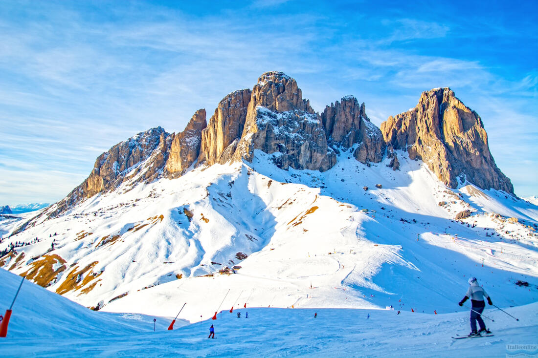
The circuit around the massif can be accessed from four towns - Selva di Val Gardena in the west, where the Sassolungo mountain (Langkofel 3181 m) rises overlooking the Alpe Siusi, Corvara in the east, Arabba and Canazei in the south.
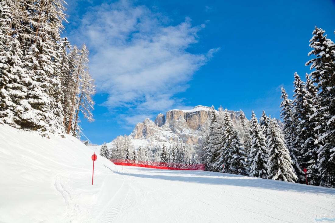
Sella Ronda in winter: a ski circuit with more than 500km of slopes
The Sellaronda links the four main ski resorts of Val Gardena, Alta Badia, Arabba, and Val di Fassa. These resorts are part of a larger area called Dolomiti Superski, which includes 12 different ski areas.
The total length of the ski runs in the Sella Ronda circuit is approximately 40 km.this circuit can be skied in two directions, which means that you have the choice between green and orange, i.e. for and anticlockwise, each with different views and different descents. However, the whole circuit is connected in all 4 ski resorts, so you can enjoy about 500 km of slopes.
It takes a lot of physical fitness to go on this world-famous ski circuit, as the slopes here are of medium to high difficulty. The Orange Circuit, which runs clockwise (in senso orario), covers up to 42 km (28 km of trails and 14 km of ski lifts). The highest point on this route is Portavescovo (2495 m).
The counterclockwise green circuit (antiorario) will take you a total of 39 km. It is advisable to set off in the morning to catch one of the last cable cars around 15:30 and get back safely to the starting point of your skitour.
One complete circuit takes about 4 - 6 hours, unless you use the additional ski runs located in each of the four resorts. It's a good idea to take the weather forecast into account too! Weather conditions change frequently during the day, so even if the sun is shining and there is no wind in the Val di Fassa, for example, on the other side of the valley on the other side of the valley, the wind can be so strong that some of the transport equipment is stopped and it is difficult to get back to your accommodation safely. Still, even in inclement weather on the mountain tops, it is advisable to drive down to one of the nearest towns and use the road connections between locations.
The Sella Ronda circuit has over 200 lifts and cable cars. The Val di Fassa area, located at an altitude of 1300 to 2950 m above sea level. there are 124 km of slopes of all abilities (4 black, 43 red and 25 blue), Arabba with the highest mountain Marmolada reaches an altitude of 1446 - 3266 m.at an altitude of 1,600 metres, you can ride up to 62 km of pistes (6 black, 22 red and 15 blue), which make for an unforgettable spectacle. In Alta Badia 1324 - 2748 m above sea level. there are 129 km of downhill runs (3 black, 26 red and 48 blue) and Val Gardena with 181 km of downhill runs (12 black, 81 red and 55 blue) at 1060 to 2518 m.1,605 m above sea level.
The most spectacular runs are Bellunese (Marmolada); Gran Risa (Alta Badia), where giant slalom is regularly run; Val Giumela (Val di Fassa) and Saslong (Val Gardena), a World Cup slope. You can do it all comfortably with one Dolomites Superski ski pass, which you can later use to go to all 12 alpine resorts.
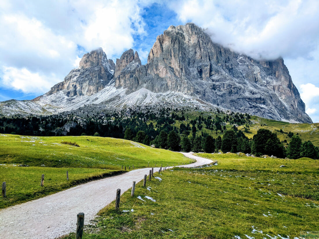
Sella Ronda in summer
Of course, Sella also offers beautiful places during the summer season, which directly invite you to go hiking, Nordic Walking, Mountainbiking and Trekking in Alta Badia. The cable car ride up the Sasso Pordoi ( 2950 m) is a real treat. a breathtaking view with possible refreshments in the Rifugio (Czech for shelter) Maria cafe.in the whole of Trentino we recommend the restaurants with the Osteria Tipica Trentina label, because the products come fromand are true to the local culinary tradition.
With coffee you can taste for example.: Strudel - the famous apple strudel, but among the most famous highland dishes in these provinces are Risotti ai funghi - risotto with local brie mushrooms, which have a very strong and distinctive flavour, or Polenta e coniglio - a dish of polenta and rabbit.
How to get to Sella Ronda?
By car
- From Prague - direction Písek ; České Budějovice ; Dolní Dvořiště x Wullowitz then Linz on the E55; Salzburg on the A1 motorway; Rosenheim on road number 8; Innsbruck on the 93 and the A12 motorway towards Brixen (Bressanone) on the A22
- From Prague - direction Pilsen on motorway D5 ; Rozvadov x Waidhaus then Regensburg on 93 ; Munich on road numbers 9, 99, 8 to Rosenheim and then the same way as in case number 1.
- From Brno - direction Vienna; take the A1 Linz and continue as in case number 1.
and then:
1) to Val Gardena by taking the exit from the A22 CHIUSA motorway
2) to Alta Badia by taking the exit from the A22 BRESSANONE / VARNA motorway and then SS49 to S.Lorenzo; SS244 to Corvara
3) to Arabba continue from Corvara on the SS244 or exit the A22 TRENTO motorway and continue on the SS47 and 50 towards Belluno, from Belluno towards Livinallongo (Arabba)
4) to Val di Fassa by taking the exit from the A22 EGNA / ORA motorway and then the SS48 to Val di Fiemme and Val di Fassa
Route charges:
Austrian motorway vignette, preferably 10 days € 8,80
innsbruck - Brenner section of the A13 € 9
Toll on Italian motorways according to distance travelled approx. € 5.50 / 100 km
By air
Nearest airports: Bolzano, Verona, Venezia, Milano, Innsbruck, Munich


